Once I have the GPS file, I spend that day flying the course on Google Earth to see exactly what roads we are using. Then I go through all my old GPS files once again and spend the next two to three days on laying the old files and course up against the new course to see if some of the sections werethe same as previous years.
Once I know certain areas of the new course match previous years, I begin transferring previous notes I took over to the new course. This is done mile by mile and also gives me a chance on Google Earth to see images of the course, which in turns gets my head wrapped around the entire course, as well as putting together a good plan once I am ready to see it with my owns eyes during pre-running.
For new sections of the course, I fly those areas mile by mile on Google Earth and look at the trail and lay in my own notes based on what I am seeing with the trail.
For instance, notes such as “hard right,” “hard left,” “sweeping right,” etc., give me a head start before I see the course in person. What I cannot see are obstacles such as rocks, water, over rises, washouts, etc. Those notes I will add once I am on course practicing.

The key is to get as much work done as possible prior to going down with our race notes. Once I am happy with how the notes are laying up for the course, I transfer everything to the Lowrance GPS I use in my pre-runner, so when we start we already have a lion’s share of the work done and my navigator can concentrate on talking me through the notes instead of taking them.
The next step is to also make sure we have our GoPro camera ready because we will shoot video of every mile of the course.
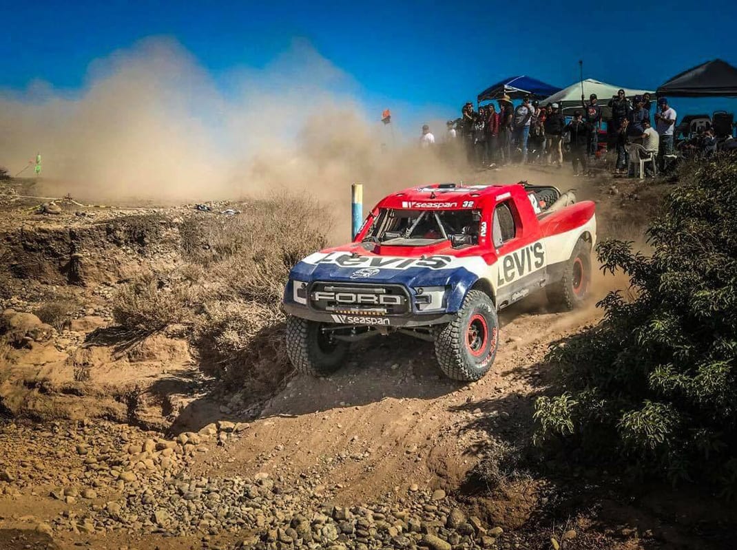
Once the pre-work is complete, our pre-runner is prepped and ready to hit the dirt and the final preparations are being made to the race truck, it is time to go to Baja and check everything we have been working toward while sitting at my desk.
There are still more notes to take or refine from our existing notes. Even though we might be utilizing some of my past notes, things always change in Baja. Weather could play a role in the race and now we have a washout where we didn’t from the previous race, rocks could be in new locations that need to be noted or officials may make a last-minute course change. We make note of those types of things and enter them into the GPS.
Remember, I have also been taking video of the entire course every day while pre-running. After every day of pre-running, I watch the video and examine different sections of the course that may hold a question mark for me, so I can get my eyes on it again and make a new plan for the next time I see it during pre-running.
With notes taken and pre-running complete, race day is near.
The day before one of the biggest races in the world, you are excited and the nerves are brewing inside you. You wouldn’t be human if you didn’t have them. The trick is how well you control them. Sometimes that’s easier said than done.
But there is still work to be done.
My navigator and I use Google Earth one last time to ensure we have everything we need and the notes are perfect. We then load them into the race truck and double check them on the GPS to make sure they look like they are supposed to prior to us starting the race.
Then, the last thing I do is take a final look at the videos to make sure the course layout is embedded in my brain, so that when the green flag waves we are one step closer to winning the world-famous SCORE Baja 1000.